2 Method
2.1 Method Overview
This method uses detailed Ordnance Survey (OS) digital map data to determine the exact location of the road links under scrutiny. The widths of the roads were measured and then the buildings within 10m of the kerb were identified. Postal Address Point data were then used to determine the nature of the buildings identified, and the number of residential buildings was estimated. The results have been compared with those obtained in the pilot study (King et al 1999). Aerial photographs have also been used to provide a further check on the results in some locations.
The method was implemented using ArcView GIS software, customised to provide relevant functionality. However, the data preparation, prior to using this new ArcView functionality, was a significant part of the method because of the nature of the digital data in its raw form.
2.2 Data requirements and data preparation
Three key data types were required in the development of this method: OS OSCAR, OS Landline and OS Address Point. Aerial photographs have also been used to provide more information about the nature of some of the roads.
2.2.1OS OSCAR
OS OSCAR data provides an accurate digital map of the whole GB road network, and therefore offers a considerable improvement on the current roadside NO2 database, which is limited to straight line representations of these links. This straight line representation of the road links was used to compile the 1996 National Atmospheric Emission Inventory and subsequent pollution mapping results (Salway et al 1999). An improved OS Meridian based map of roadlinks, at a resolution appropriate to the national scale mapping, is currently being used to compile the 1997 NAEI.
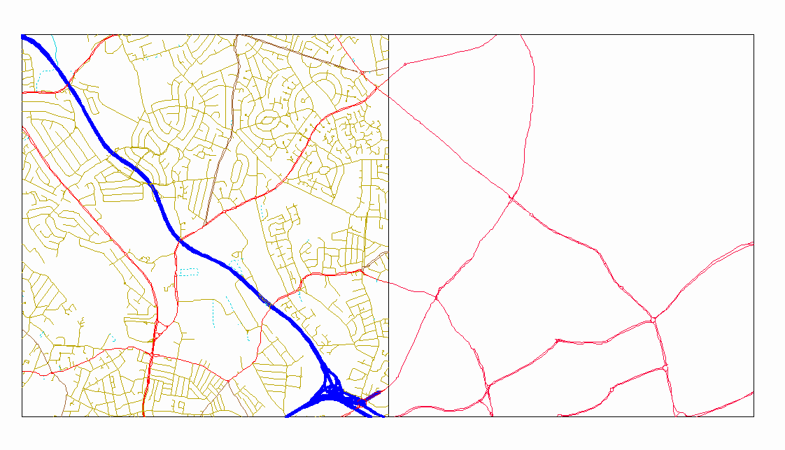
As with all OS digital maps, the OSCAR data is organised into a series of square tiles covering the whole of Great Britain. In the case of OSCAR data these tiles are 5km across. For each city, the relevant OSCAR tiles were selected and the 'A' roads were extracted, as all of the road links considered within the national modelling for the review of the NAQS are of this type. Figure 1 shows two example OSCAR tiles, one with all the detail and one with just the 'A' roads. The lines in the OSCAR data set actually correspond to the road or carriageway centre lines, and hence for dual carriageways there are two lines.
2.2.2 OS Landline
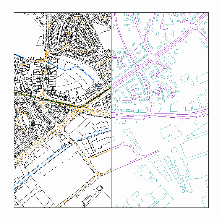
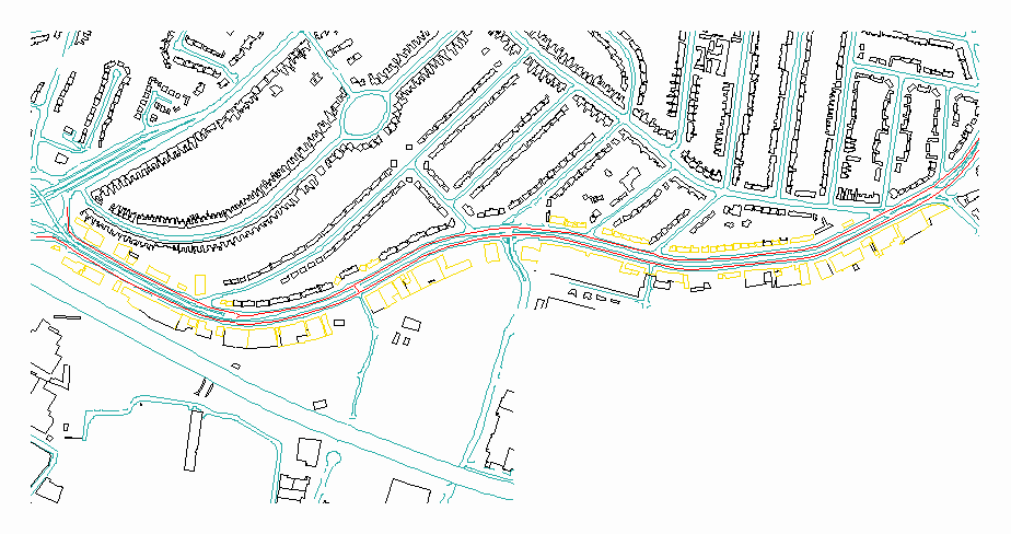
OS Landline is a very detailed digital map, which, in urban areas, is made up of a series of 500m square tiles. The Landline maps include outlines of every building and of road kerbs. Many other details are also included, such as property boundaries and watercourses. The relevant tiles adjacent to the road links were selected, and the buildings and kerb lines were extracted. Figure 2 shows examples of the Landline tiles.
Figure 1 Two OSCAR tiles
Figure 2 Landline data
The OS Address Point data consists of a series of points defined by grid references. These points correspond to each postal delivery address location, which are nominally the location of the letter box. The digital files are organised by postcode sector. Sectors covering the links under scrutiny in each city were identified, and those points that fall within the area of interest extracted. Figure 3 shows the Address Points that exist within one of the Landline tiles in Figure 2.
Figure 3 Address Point data
2.2.4 Aerial photographs
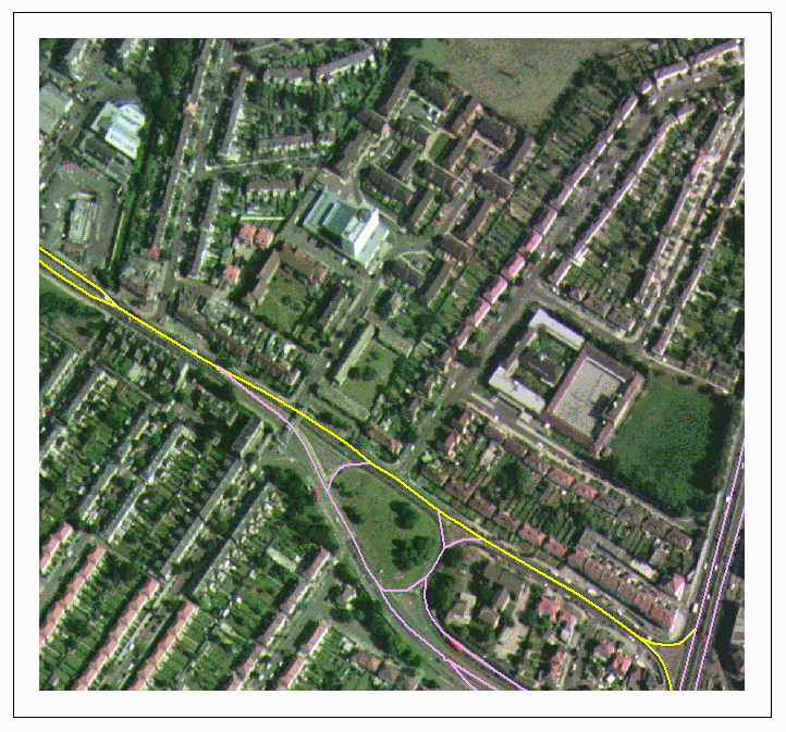
Aerial photos have been obtained from the National Remote Sensing Centre. These are available in 1km tiles, which cover a selection of cities in the UK. Photographs have been obtained for a small selection of road links in London, Birmingham and Manchester. The data have primarily been used to provide further contextual information to clarify any uncertainty. Figure 4 shows an example of the aerial photography data with the OSCAR data overlaid.
Figure 4 An example of the aerial photography (London A4088 link 57656)
2.3 Method used to select addresses
A series of tools were developed using Avenue, the ArcView programming language. These tools provide an element of automation in the processing of the OS data.
The road links studied were those visited as part of the pilot study, as described in King et al (1999). The OS data were prepared separately for each city in this study. Once the data had been prepared, each link could be examined in detail.
Firstly, in order to determine which buildings were within 10m of the kerb, the distance of the kerb from the road centre line was measured manually at a number of points along the road link. This was required because the kerbline data was not in a format that could be used to measure the distance from the buildings directly. The average distance of the road centre to the kerb was often 3 to 6 metres and therefore the distance used to test for exposure was 13 to 16m from the road centre line. If large variations in road width existed then a maximum and minimum distance were used for the next part of the analysis.
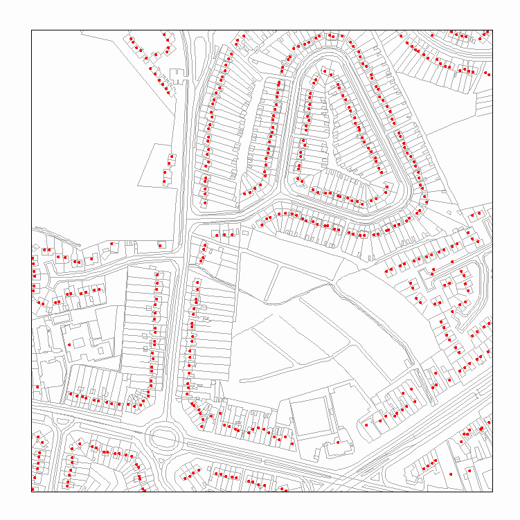
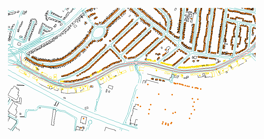
Secondly, all buildings were selected that had a façade within the calculated distance from the road centre line. Figure 5 shows this selection, with buildings within 10m of the kerb coloured yellow.
Figure 5 Selected buildings
Once the buildings had been selected and checked, the Address Point map was queried to select those points that correspond to the selected buildings. Again, the results of this selection were checked manually to ensure that no Address Points were missing or had been included incorrectly. Figure 6 shows the Address Points selected, also in yellow.
Figure 6 Selected address points
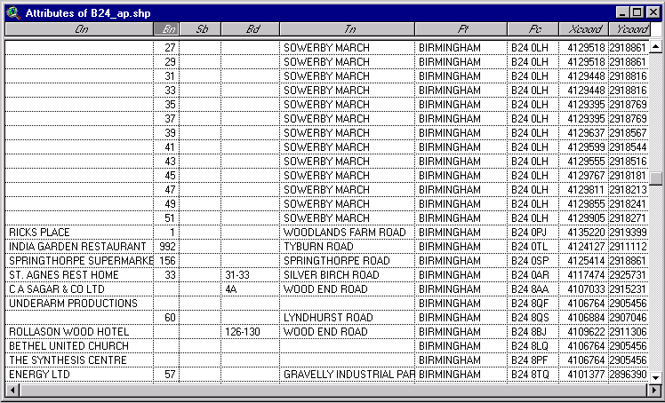
The last stage of the process was to identify which of the selected Address Points correspond to residential buildings. This was performed using the assumption that non-residential buildings have some sort of business or organisation name in the Address Point database (in the 'On' column in the table below). The residential building count therefore only includes address points that have no name.
Where the road width is variable along the route two selections have been made: at a minimum distance form the road centre and a maximum. This provides a range of possible exposed households. On some roads where lots of residential buildings were found, this range was examined to determine which estimate is most accurate.
Table 1 Address Point data showing residential and non-residential addresses